Monday, January 28, 2013

Carthage

January 26, 2013 25 degrees. Cloudy. When we arrived we climbed out of the car and got warmed up (a tough task on this day) in front of Su Casa, which is in an old school building just off Carthage’s main business strip. We started south on Fairpark, heading through the residential area which looks similar to other northern-Cincinnati neighborhoods. There is a clear architectural mish-mash (my technical term) with really old brick two-stories next to more modern models (mine, too). Kayla pointed out this row of Potter Hill homes.
We made our way east back to Vine Street, where we emerged in the business district. Here Carthage's Latin American influence emanates throughout the district. El Valle Verde, a restaurant/grocery store, takes up about a half block. In the next block is a coin laundry with two suns on its sign: they were good stand-ins for the one that was missing on this gray day.
Down the street from El Valle Verde was this doctor's office, which is unlike any building I have seen in Cincinnati. On first impression, Kayla thought it was the library.
Our last stop before leaving the business district was Carthage's ArtWorks mural. This mural is entitled “A Postcard From Home.” At the top is a bilingual banner which reads “welcome to all”/“bienvendios a todos.” Contributing to the spirit of welcoming was a teenager who actually said hello to us as we ran by.  In such close proximity to the mural it seemed significant.
I should also add that Carthage is the first neighborhood where we spotted another runner. This guy was a boxer. He donned a cut-off sweatshirt and wore his hood up as he threw left and right jabs. We didn't stop and ask for a picture. Just beyond the business district, the layout transformed from quaint storefronts and unique architecture into car lots with giant Native Americans (there’s only one of these).
That is Chief "Pontiac." Not to be confused with Chief Pontiac.
Apparently the dealership's jingle was, “Where Paddock meets Vine at the Big Indian Sign...” History says the Chief’s arm once moved up and down and was decked with neon lights. Is the Chief just harmless kitsch, representing a different era, or is he a demeaning caricature? Up the street from the caricature, we arrived at the Seymour Trailhead.
This was a great discovery, as I am always on the lookout for new trails. The stretch of trail we ran was quite short, yet it was also very scenic and totally flat.
The trail would be a great place for some short, fast workouts. I ran along it imaging it being someday connected to Northside's greenway trail. Such an extension would result in just over 3 miles of trail. Then--just when I thought I was on to something--I came across this organization that is working for a 28 mile trail along the Mill Creek. Even better.
At the end of our run, I wanted to stop at the beer depot and get a picture of this "ice cold beer" sign. In hindsight, this was a terrible decision.
As I lined up the shot, I heard what I thought was a little kid screaming at the top of his lungs. None of my business, I thought. When I came to the alley next to the beer depot, I found the screamer--it was Kayla, and she was on her back holding her ankle. She had slipped on the ice (and, mistaking her for a little kid, I had totally ignored her). Fortunately, we got her to the car which was only a few blocks away. She spent the rest of the day watching Tia and Tamera. As of this writing, our challenge is not in jeopardy: consistent application of reality television has reduced most of the swelling.
Unfortunately, grand, all-encompassing reflections on Carthage were limited by the urgency of the slip and fall. However, a trip back to El Valle Verde is definitely in order, and hopefully someday Carthage can be a nice stop along a fantastic trail.

Thursday, January 24, 2013

Route #5: Carthage

I have been to Carthage exactly once. It was a pilgrimage of sorts. Four years ago, Jess Linz and I drove from Lower Price Hill to Carthage to meet a woman who we knew from newspaper clippings and neighborhood folklore. She had worked in Lower Price Hill as a community organizer in the 1980s and had formed a tenant cooperative, of which only a few empty buildings remained. 

But that’s not why we went to Carthage. This woman had worked out of the same third-floor office that I was working in at the time. When I started my job, I found a slim file in one of the cabinets: a Xeroxed article about her organizing efforts with Latino immigrants. Having the same assignment all these years later, we wanted to meet her to give our work the historical context that it deserved. We heard from neighbors that she had left Lower Price Hill to do organizing work in Carthage. And so off we went, Mapquest in hand.

Donnie and I will start our Carthage run from Su Casa Hispanic Center, where Jess and I met this legendary organizer.

From there, we will run down Fairpark into the residential section of the neighborhood, and then back up Vine Street. We will take Vine Street past the site of the Hamilton County Fairgrounds, then get back on Fairpark to Seymour. Seymour will take us to the Mill Creek Greenway Trail.

There are two large parks in Carthage, and we will get as close as we can to Caldwell Park. If we can access it from the Greenway Trail, we’ll take a detour to run through before heading back to the residential section via North Bend.


You can see the full route with milage markers here.


-Kayla


Monday, January 21, 2013

Camp Washington

MLK Jr. Day, 2013. 24 degrees with wind gusts up to 26 miles per hour. Partly Sunny. This was what the flags looked like when we were on our way to the start of our run. In the midst of a winter filled with days in the 50s and 60s, today was a return to normal. So, equipped with our windbreakers, tights, and warm gloves we parked behind Camp Washington Chili.
But we couldn’t leave before Kayla took advantage of pointing at her surname in front front of the Camp(y) Washington Mural.
As you can see from this photo (circa 2010), this practice applies to first names, too.
The "Campy Washington" Mural was a fitting starting place. In the summer of 2008, the mural, which featured George Washington in a ball gown, was the epicenter of controversy. The mural's detractors didn’t appreciate seeing a forefather donning a ball gown with flying pigs doing laps around his head. (I think George pulls it off well). High-art controversies aside, "Campy Washington" captures a theme that is ever-present throughout the neighborhood: Reinvention. Taking something old and making it new. The Machine Flats was the first site of reinvention that we encountered. The project is an old factory turned luxury flats. From the outside the flats looked awesome--Kayla tells me that inside they are pet friendly and spacious. On one level, this is a place I could imagine living; although a UDF would be nice. The flats also made a great photo-op for Kayla “The Machine” Camp.
When we rounded the corner from the Machine Flats, Kayla stopped to snap a picture of this old factory, which represents a lot of the building stock (I stole that term from Kayla) throughout Camp Washington. With Machine Flats as an example of how such spaces can be given new life, these factories seem full of promise. Yet, on the other hand, they are so numerous that the challenge of total transformation seems daunting.
We also stopped in a park so I could have a photo that was as awkward as Kayla's. (note the jail in the background)
Despite the freezing cold temperatures and high winds we glided through Camp Washington at a much faster pace than usual. (freezing temperatures made for fewer photo stops). Camp Washington has to be the only neighborhood in Cincinnati where you could do an entire run without having to climb a single hill. I could imagine incorporating it into a long run at some point.
As we made our way along Spring Grove Ave. we passed another symbol of reinvention--the former Kahn’s meat packing plant--which is now a City of Cincinnati brownfield redevelopment. This is a massive site that will undoubtedly be a great home for a new business. (maybe a factory that produces sustainable running shoes?)
Down the street from Kahn's was this sign for Recycle America.
The Recycle America sign was prophetic: a left turn off of Spring Grove brought us into Camp Washington's post-industrial heart. The differences from block to block were notable. On one block a group of machinists directed a semi-truck into a loading dock. Their careful choreography suggested a bustling industrial landscape in which this kind of thing happens all the time. Yet in the next block, an empty lot contained nothing more than smashed glass and wrecked cars. Undoubtedly the area is a microcosm for the complicated state of American manufacturing. Of course, this run took place on Inauguration/ MLK Jr. Day, so those events were on my mind. Once we left the blocks filled with manufacturing, we entered Camp Washington's main residential area. This is the part of Camp Washington I know best. At the corner of Sidney and Rachel is the Washington United Church of Christ which hosts an after school homework club for the kids of Camp Washington. My visits to Homework Club always led me to feel hopeful for the future of the neighborhood. These kids were always enthusiastic, insightful, and excited to be a part of the program. They were no doubt a part of the unifying light that Richard Blanco spoke of throughout his great poem. The housing throughout this area brings to mind the classic Italianette structures that are present in many of Cincinnati's oldest neighborhoods. (Thanks to Kayla for the assist with that one--I thought they were called German houses).
When we emerged from the backstreets for the final time we were at the intersection of Colerain and Hoppel. To our left was Camp Washington's business district, a strip that includes a fish restaurant, an AFL-CIO hall and a hardware store. Across the street there was an old man bundled in four coats, wearing a backpack. Across the intersection was a man wearing a giant, red cardboard fish--a human billboard for the fish restaurant.
Camp Washington was probably my favorite run so far. Not only because it was totally flat and had just a few stop lights, but because like any great course it shed new light on a place that I didn't know that well. -Donnie

Sunday, January 20, 2013

Route #4: Camp Washington

The three day weekend gives us a good chance to get a little bit ahead of schedule. Who knows when one of us might jet off to Cancun or come down with the flu and we have to miss a week of ticking off another neighborhood?

Also, this is my first attempt at course planning, so we’ll see how that goes!

Camp Washington is an industrial and residential neighborhood known for its factories, railyards and stockyards. I found this fascinating video on the History and Morphology of Camp Washington.

We will start our run from Camp Washington Chili. Since they don’t offer a vegetarian chili option I can’t really compare it to the other Cincinnati Chili parlors.

I wanted the route to include a good mix of the residential and industrial sections of the neighborhood, so I made sure that we have the opportunity to spend some time winding through the residential streets.

The Machine Flats Apartments at 3301 Colerain are a good marriage of these industrial and residential components—a former factory building converted into luxury rentals. I toured the building soon after it opened as part of a Community Development Corporation Association bus tour.

Another factory conversion in Camp Washington is the American Sign Museum--a cool collection of retro signage.

We’ll also take a look at the site of the former Kahn’s plant at 3241 Spring Grove Avenue. The plant was demolished in 2012 as part of a brownfield remediation program. 


-Kayla

Saturday, January 19, 2013

California

January 19, 2013. 50 degrees and so sunny. Windy.

Of all the runs on our list, California is the one I’ve been looking forward to the most. What is this place nestled along the river in the far corner of the city? The land of amusement parks with a name evoking sunshine. California. It almost feels anticlimactic to have arrived at this point so early in the year.

Obviously, before we left we had to pose with our books and our money:


It didn’t take long to drive through the East End along Kellogg Avenue to Coney Island. We had hoped to park there, but it is battened down for the winter:


The dry water slides and the white skeletons of poolside umbrellas were visible from the road:


We passed Riverbend Music Center and River Downs before pulling over to park along the Ohio River Trail.


At this point we had technically left Cincinnati and entered Anderson Township, but it was just a quick jog past the amusement parks before we entered California proper:


Look, I don’t know what it is about the pictures Donnie has been taking of me lately. Could this get any worse? It looks like I had a rough night. Which I did if you consider watching the third Twilight movie in my pajamas while eating basil-mozzarella balls rough. I consider it a luxury, so really there is no excuse for this picture.

Or this one:


Geez.

The business strip in California is something out of a movie. Lebo’s, known for its Karaoke nights, occupies a beige-brick building close to the street:


California Deli is on the next block:


And the California Columbia United Methodist Church is a bit further up:


The residential district behind the storefronts reminded us of rural towns we have loved: Thoreau, New Mexico; Lewiston, Michigan. Small houses on streets laid out on a grid. No need for sidewalks. Barking dogs in the yards. This sign guarding a junkyard:


Speaking of guns, we soon found out that we would have to amend our original plan to run in the California Woods Nature Preserve:


Hunters in the woods, stay out? You don't have to tell me twice!

Instead we ran up a steep hill to the Cincinnati Recreation Commission California Golf Course:


The course and the clubhouse are lovely:


But the real sight to see is the Cincinnati Water Works reservoir, which looks like Lake Tahoe under the bright blue sky:


I had Donnie pose like he was on the boardwalk:


Because that’s what you do in California.


Friday, January 18, 2013

Route #3: California

Neither of us has ever been to California, so tomorrow will be a first. We will start from Coney Island, wind our way into the residential district and then head north to the California Nature Preserve. It's supposed to be a nice day, so we might head of course in the preserve and see where the trails take us!

Saturday, January 12, 2013

Bond Hill

62 degrees (in January!). Overcast.


The morning started off a bit rocky as we struggled to resuscitate Donnie’s Lebaron, which we had been planning to drive to Bond Hill and leave in the CAA lot during our run. Its near-demise was perhaps the result of Donnie having fed its backseat a steady diet of Skyline wrappers, apple cores, and other assorted garbage. Keeping it classy.

Anyway.

The Community Action Agency shares its parking lot with a branch of the public library and beauty supply store. Donnie took this photo of the building before we even pulled into the lot:


Not to be outdone, I crouched under the front entrance, flexed my photography muscles, and took this one:


Before setting out on our run, I took quick bathroom break at Cap’t Dees.

We took a left out of the parking lot and ran down Reading Road along the hedges hiding the golf course.


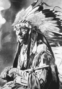
At the entrance I asked Donnie to pose for a picture in front of the Maketewah Country Club sign:


I don't think they would let him drive his Lebaron there.

Bond Hill has two stretches of commercial store fronts. The first one that we came to is along Reading Road.  There, Donnie pooh-poohed the idea of taking my photo in front of the “Gold Teeth” sign. Instead he waited until we got off the strip and took this picture of me, which will perhaps go down in the record books as one of the most awkward photos ever taken:


This is front of PACE High School, which obviously used to be a Catholic Church.

Next, we ran through the residential sections of Bond Hill until we came to the neighborhood’s second business district along Paddock Road. From there we ran back along the golf course:


Many of the homes in Bond Hill are gorgeous old tudors like these:


Paddock leads to Regina Greater Way and the Greater’s Manufacturing plant:


Please tell me that the photo of this ice cream truck was worth the trouble of following Donnie through a muddy field and ruining my new Asics. Actually, don’t bother. It's a pretty lame photo and my shoes will never be the same.

The Greater’s manufacturing plant is the first of several warehouse-size buildings in a great stretch of business parks:


The sidewalks that line the business parks are wide and set back from the street. We weren't surprised to see other people out for exercise--a woman in walking clothes, and then a hoard (Do I mean a herd? Not sure why hoard came to mind, unless I was still thinking abou Donnie's car.) of bikers:


Next we stood forever waiting for a Walk light to cross Seymour:


And then we ran up on the grounds of the Summit Behavioral Health Center. The building is a cool contemporary-looking structure with a big “A” shaped entrance and round windows.

At the back of the building you can see into an interior courtyard with basketball hoops and picnic benches. Just as I remarked how the courtyard windows made the facility a literal Panopticon, an Ohio State Trooper in his brown uniform crossed the lawn and wagged his finger at us asking us to approach him.

He asked us if we knew where we were and without waiting for an answer, informed us that we were on the grounds of a state institution. “What are you doing here?” Just joggin’. “Well, don’t come back.” Yes sir, understood.

Whoops.

Our route was less than 5 miles so we added on a little bit by running through the Villages of Daybreak, a newer subdivision with suburban-looking homes laid out in a traditional neighborhood design, close to each other and to the street:


Although the streets were empty at 11:00 AM on a Saturday, I could picture families walking together after dinner on summer evenings—parents pushing strollers and kids on bicycles weaving down the street.

Having only completed two of our fifty-two neighborhood runs, I couldn’t help but compare Bond Hill to Avondale. I decided that Bond Hill seems to be a bit more wide-open, almost as if it has been stretched to fit around the golf course in the center.

California is up next.