Showing posts with label cincinnati trails. Show all posts

Saturday, August 24, 2013

Run 52: Mt. Washington


This week took our run took us to the alphabetic end of the Cincinnati “Mounts” and to the geographic end of Cincinnati’s eastside. That's to say, we ran in Mt. Washington.
Mt. Washington is home to the largest neighborhood sign this side of the Mississippi, and second only to Hollywood. After getting acquainted with the big sign, we headed to Stanbery Park.  There we discovered this Salamander that brought to mind our raccoon friend from Mt Airy, but was slightly less ominous.
I was excited to visit Stanbery Park for what appeared to be a good number of trails that we could explore. Unfortunately, at the head of nearly every trail was this sign:
Kayla the rule follower didn't want to test the authority of the park sign, so we trudged on. We decided to make a couple of loops around the interior of the park, which is quite spacious and also a popular make-out spot for local teens (not pictured).
Because the closed trails threatened to cut our tour short, we needed to find an alternate route. Kayla came up with the idea of venturing into the Mt. Washington Cemetery.

After crossing through the gates, we found this ornate gravestone dedicated to a man who was lost at sea.
The graveyard was a great pick from a running standpoint. The wide gravel path made for a great running surface. From the graveyard we made our rounds through some residential blocks. The mix of homes brought to mind Kennedy Heights and Hartwell.  Still, Mt. Washington has its own feel as it is one of Cincinnati’s "annexed" neighborhoods, which is evident from the viaduct that separates it from the rest of the city.


One of the buildings that stands alone in Mt. Washington is the elementary school which maintains a classic vibe even after its recent renovation.

On our return loop, we took a jaunt through the business district.  To the one-time ice-cream saleslady Kayla, the cornerstone of the business district is the Mt. Washington Creamy Whip. First, she made me cross Beechmont Ave. and get the perfect shot of her striding by the storefront.
Then she had me cross back over four lanes of traffic Frogger style and get this shot of her lounging in front of the Creamy Whip signage.
Finally, she insisted that we return to the Creamy Whip later that day.  
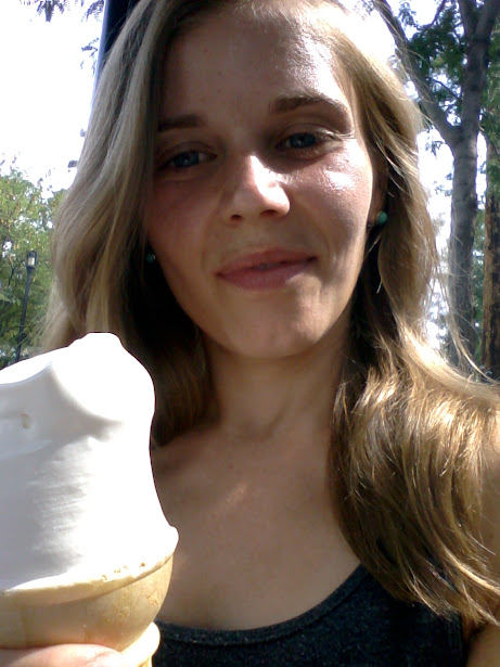
As I was enjoying my swirl, the little kid at the table next to us who said, "Hey, Dad look at that guy!" I looked over to see this kid pointing at me. From this picture, I can only guess that he was concerned that the cone was larger than my head.

Kayla's edit:  This was actually hysterical.  I mean, what's to see?  A guy eating a creamy whip in his Saeed and Little jersey?  The kid's dad had to manually turn his head to keep him from staring.  Ha!
We had a great run around Mt. Washington and we left with more than a few good reasons to return.  Here are a few: (1) the prospect of open trails at Stanbery Park, (2) the Mt. Washington Creamy Whip, and (3) a Little Caesars where I can grab a Hot-N-Ready to bring to my next potluck.

To see the entire route go here: http://www.usatf.org/routes/view.asp?rID=523637

Sunday, August 18, 2013

Run 52: Mt. Lookout


First things first.  Here is the prettiest pooch in Mt. Lookout:


When we left for this run, Zola Budd watched through the patio door as we headed down the driveway without her.  Like on our Linwood run, we started our Mt. Lookout route from home.  We live right on the border of the two neighborhoods, but the Auditor’s website says we live in Mt. Lookout, so that’s what we’re going with.  
Like in many of the neighborhoods we’ve run so far, it’s impossible to run in Mt. Lookout and avoid the hills.  We started by turning up Sheffield and then again up Heekin.  And I was dying already.  My lungs were burning.  My legs were burning.  And my face looked--strangely--flat as a pancake:
 

But it was totally worth it because at the top of Heeken is Ault Park, which is one of the loveliest parks in the city.  I’m going to get all Leslie Knope here, but to live in walking distance of a park like this means everything. 


We even ventured onto the trail for a short while.
 

Leaving Ault Park, we ran through the neighborhood, which has quiet streets with lots of tutor and craftsman style homes. 
 

The white house on the left is where we lived when we first got married and moved to Cincinnati.  I’ll always remember rolling up with three bad cats and a U-Haul full of clothes from the Buffalo Exchange.  The neighbors must have been thrilled.

When we lived in this house—which backs up to a wooded ravine—a herd of deer would often hang out in our backyard.  When we run in Mt. Lookout we always see deer, including this one, who was actually feeling pretty nonchalant about snacking on this person’s front yard:

And then there is Mt. Lookout Square, which is what attracted us to the neighborhood in the first place.  The square has EVERYTHING you could ask for in a business district: four bars, two pubs, sushi restaurant, Mediterranean restaurant, pizza place, Thai restaurant, Subway, gift shop, four salons, dance studio, vet’s office, coffee shop, interior design store, photography studio, brunch place, bookstore, gelato shop, funeral home, dry cleaner, oil change place, shoe repair, boutique, chiropractor, drug store, realtor’s office, bank, music venue. 


Oh, and a fully-stocked UDF, which tops Donnie’s list of neighborhood must-haves.  When we moved out of Mt. Lookout for a few years, Donnie would often complain that he missed being able to walk down to the UDF to get a post-run Gatorade. 

Personally, I don’t think it gets much better than some vegetarian cabbage rolls and happy hour:

I don’t know if it’s just me, but sometimes I get an Alpine feel from Mt. Lookout Square.  I think the hills and the hustle and bustle call to mind a thriving ski town during peak season. Or maybe the association just comes from Alpine Avenue, which is the steepest hill we’ve climbed on Run 52.  So steep, I’m embarrassed to say, that I walked the last dozen yards:

We looped around Alpine, down Paxton, and then back through the Square.  The bouncer at Mount Lookout Tavern was otherwise occupied so stood in for him for a few minutes.  When I saw what he was doing, he snorted a little bit like I had no business acting like I could keep the hooligans out of the bar:


Next, we ran past Our Lord Christ the King Church.  I love that Jesus is giving the peace sign.  This statute also always makes me think of the intro scene of Baz Luhrmann’s, Romeo and Juliet, which I swooned over in the eighth grade:

I also saw it fourteen times in the theater, in case you’re wondering how I spent all that money I made scooping ice cream.
So that was the run.  To celebrate the Mt. Lookout leg of Run 52, we returned to the square on Friday night for burgers (cow for Donnie, bean for me!) at Zips, followed by gelato at Buona Terra:
 

I had the tiramisu flavor and Donnie had cookies and cream, but they also had Earl Gray and a white chocolate lavender flavor for those with more sophisticated palates.  Like with many things, we go by this place every day, but it was the Food Hussy’s review that got us to stop in. 
I don’t know how to wrap this up except to say that I love this neighborhood.  I love the park, the hills, the trees, the drive to work along Columbia Parkway.  I love the deer and the gelato.  I love the black bean burger at Zips.  I even love this old cat, who hangs out in the storefront window of the photography studio, and who Zola loves to terrorize:

The running is not bad either.


-Kayla


Full route with mile markers: http://www.usatf.org/routes/view.asp?rID=523295
 

Saturday, August 10, 2013

Run 52: Mt. Airy

On Sundays my college cross country coach would drive our team to the forest preserve and leave us with the same instructions, "go get lost."
 
Some of the team took this advice to heart; they would run blindly into the woods, seeking out winding stretches of single-track trail until they were absolutely lost. The most lost of us required search teams to bring them back. Fortunately, I was never in that extreme category--I always made it back before anyone came looking. My secret was simple: follow the sun.
 

Mt. Airy forest was the perfect place to get back in touch with my navigation skills. If I’ve heard it once, I’ve heard it a thousand times: Mt. Airy is the largest municipal forest in the United States. That means it's larger than Central Park. It’s one thing to hear someone utter those words and another thing to actually drive into the forest and see the sheer scale for yourself.

Before we even got out of the car, we came across this possibly rabid--and most definitely angry--raccoon.  He(?) didn’t flinch when I stopped to take a picture.


Starting out from the parking oval off Colerain, we had a few trail options.  For no good reason we picked the H Trail, which starts with a steep and rocky descent into the woods. Here I am silently nervous that a raccoon crossing our path might be bad luck:

 
And here is Kayla, feeling a bit brazen:


If you’ve been following the blog, then you know that my love-hate relationship with trails is well documented.  To make matters worse, I started this trail run feeling a bit sluggish after a trip to the all- you-can-eat buffet at the Horseshoe Casino the day before.
 
With me grumbling behind her, Kayla led the way down the steep path; this was a good call as she is very agile (lots of free yoga classes) and I am very clumsy (lots of Greek yogurt in glasses). Fortunately, we would discover that Mt. Airy isn't all rocky terrain. 

(Kayla here, proofing this piece.  Not sure what to make of this last bit.  Yoga classes?  Greek yogurt in glasses?  What is this, Dr. Suess?)


After a good bit of exploring beneath the forest canopy, we emerged in a grassy field that reminded Kayla of Twilight, which reminded me of Kayla watching and reading Twilight while I pretended to gouge out my eyeballs. 
 
When Kayla stopped prancing around the meadow, I told her we were lost.

Puzzling our way in search of some familiar marker, we came to a sign for the Ponderosa Trail.  This seemed vaguely familiar, but, then again, I could have been associating the Ponderosa trail with the  Ponderosa buffet with the Horseshoe Casino buffet.  Nonetheless we forged on.


The Ponderosa trail has everything that I look for in a trail: well-packed dirt, very few roots, soft turns, and a few  gradual climbs.  I could run on a trail like that all day every day. Enjoying some running rhythm, I forgot that I had no clue where we were.

At the edge of the Ponderosa trail, I stopped and looked into the trees. Where had the sun been when we started? I was pretty sure we had been running toward it and that now we should turn and head away from it in whatever way we could accomplish that. Kayla agreed.


Soon we began to see familiar signs: a cedar trail sign with red arrows; a footbridge with a few missing steps; a steep slope.


And then, at the top of our final climb we were back at the parking oval. Thankfully, my navigation skills hadn't failed me, and we actually managed to see a good bit of what the trails had to offer. 


Before heading home, we explored a bit of the Mt. Airy neighborhood that lies outside of the forest.  We found a quaint business district and some charming homes.


But for the runner, Mt. Airy is all about the trails. 

--Donnie

P.S.  No map or route on this one, just drive to the trailhead and take off!